1556 Shaanxi earthquake
One of the deadliest earthquakes in recorded history.

Wikimedia Commons · Public domain
- Location
- Huaxian, Shaanxi, Ming dynasty
- Magnitude
- Approximately Mw8.0 (possibly Mw7.9)
- Intensity
- XI (catastrophic damage) on the Mercalli scale
- Direct deaths
- Roughly 100,000 (modern CEA estimate)
- Affected provinces
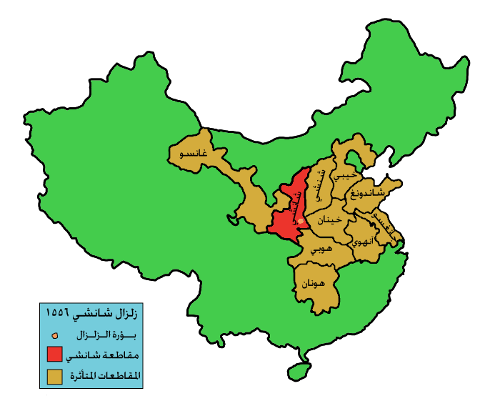
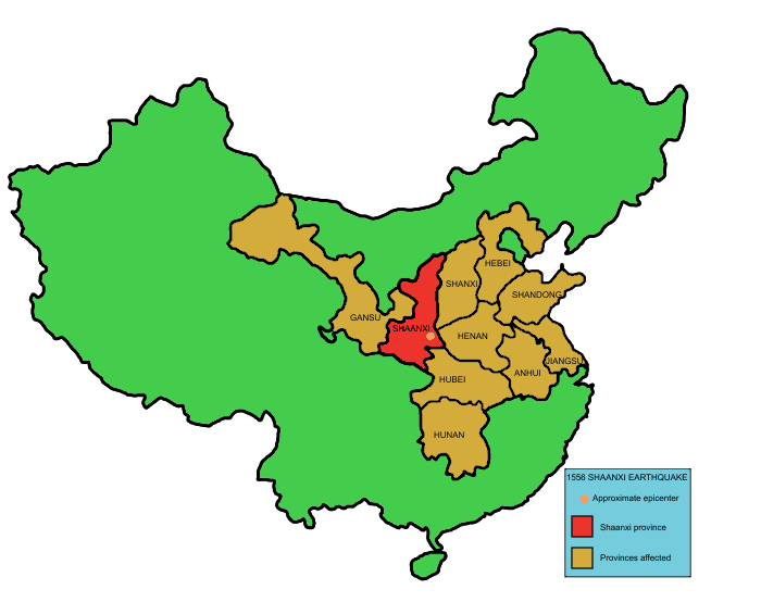
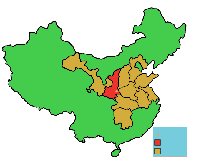
- 10 (Shaanxi, Shanxi, Henan, Gansu, Hebei, Shandong, Hubei, Hunan, Jiangsu, Anhui)
Lore & Background
The earthquake struck in the early morning, when most residents were sleeping in yaodongs—artificial caves in loess cliffs. These collapsed, burying people alive. The epicenter was in the Wei River Valley near Huaxian, Weinan, and Huayin. Huaxian was completely destroyed, with more than half its residents killed. In some areas, 20-meter-deep crevices opened, and landslides contributed to the massive death toll. The shaking was felt strongly across the Weihe Basin, with maximum China seismic intensity XI to XII in Huaxian and Weinan. The earthquake occurred during the reign of the Jiajing Emperor, and in Chinese historical records it is often called the Jiajing Great Earthquake. Contemporary accounts describe mountains and rivers changing places, roads destroyed, ground rising into hills or sinking into valleys, and streams bursting forth. The Small Wild Goose Pagoda in Xi'an lost three levels due to shaking. Modern geological studies estimate the earthquake had a magnitude of approximately Mw8.0, though more recent discoveries suggest Mw7.9. Aftershocks continued several times a month for half a year. Empirical scaling relationships suggest a magnitude of 7.0–7.5 if both faults ruptured, indicating previous magnitude estimates may have been overestimated.
Reader's Guide
The collapse of yaodongs—artificial caves in loess cliffs—was the primary cause of death, highlighting how traditional housing construction can amplify disaster risk. This underscores the importance of considering secondary impacts in disaster planning. The event also prompted practical advice from survivor Qin Keda, who recommended staying indoors and crouching down during shaking. Geologically, the earthquake remains a key case study for understanding normal fault ruptures in the Weihe-Shanxi Rift System, though ongoing research questions the accuracy of earlier magnitude estimates. The uncertainty about fault scarps and magnitude highlights the challenges of reconstructing historical earthquakes from limited geological evidence.
Did You Know?
- The earthquake destroyed Huaxian completely, killing more than half its residents.
- The Small Wild Goose Pagoda in Xi'an lost three levels due to the shaking.
The Yaodong Tragedy and the Human Toll
The single greatest factor behind the staggering death toll of the 1556 Shaanxi earthquake was the widespread use of yaodongs—hand-dug artificial caves carved into the high loess cliffs of the Loess Plateau. Millions of people across the affected region made these earthen dwellings their homes, and when the ground shook in the early hours of 23 January, countless caves caved in on their sleeping occupants. Landslides triggered by the shaking compounded the disaster, burying entire communities. The China Earthquake Administration's modern publications estimate roughly 100,000 people died directly in the quake itself. However, the aftermath proved equally devastating: famine and plague swept through the devastated provinces, and hundreds of thousands more either perished or fled their homes. In the imperial hukou registration records, the total population reduction across the affected area reached 830,000. A handful of CEA staff scientists, uncomfortable with the agency's refusal to publish a single total-death figure, offered their own estimates ranging from 450,000 to 530,000, underscoring how the true human cost remains difficult to pin down.
Tectonic Setting and the Fault Rupture
The 1556 quake struck within the Weihe Basin, a rift basin that marks the southern and eastern edges of the massive Ordos Block. To the east, this basin flows seamlessly into the Shanxi Rift System. The basin first opened during the Paleogene under northwest-to-southeast extension, then fell quiet before reactivating in the Neogene under a shifted NNW-to-SSE stress direction—a pattern of activity that persists to this day. The basin has a half-graben shape, with its southern boundary controlled by major normal faults including the Huashan Fault and the North Qinling Fault. These same faults have produced large earthquakes throughout recorded history. Modern geological studies published between 1998 and 2017 identified fault scarps along both the Huashan and Weinan faults, with heights ranging from roughly 3 to 8 metres depending on the study and location. If both faults ruptured over a combined length of about 90 kilometres, empirical scaling relationships suggest a moment magnitude of 7.0 to 7.5, leading some researchers to conclude that the earlier Mw 8.0 estimate was too high and that Mw 7.9 is more probable.
The Scope of Physical Destruction
The epicenter sat in the Wei River Valley near Huaxian, which is today part of Huazhou District in Weinan. The city was obliterated, with more than half its residents killed, and the neighbouring towns of Weinan and Huayin suffered comparable devastation. In some locations, the ground split open into crevices twenty metres deep. The shaking was powerful enough to reduce the height of Xi'an's Small Wild Goose Pagoda by three storeys, and it broke forty of the 114 Kaicheng Stone Classics in the famous Forest of Stone Steles. The disaster's reach extended roughly 500 kilometres from the epicenter, and more than 97 counties across ten provinces—including Shaanxi, Shanxi, Henan, Gansu, Hebei, Shandong, Hubei, Hunan, Jiangsu, and Anhui—suffered damage. In the hardest-hit counties, up to 60 percent of the population was lost. Even distant cities such as Beijing, Chengdu, and Shanghai reported slight structural damage. Aftershocks continued at a rate of several per month for roughly six months after the main shock, keeping the region in a state of prolonged terror and preventing stable recovery.
The Jiajing Record and Voices from the Aftermath
Because the rupture occurred during the reign of the Jiajing Emperor, Chinese historical sources consistently refer to this event as the Jiajing Great Earthquake. The official annals paint a vivid picture: mountains and rivers supposedly shifted position, roads vanished, the ground heaved into new hills or dropped into new valleys, and streams burst forth without warning. Huts, government buildings, temples, and city walls all collapsed in an instant. The scholar Qin Keda, a survivor, left a remarkable personal account and offered practical survival wisdom: at the very onset of shaking, people indoors should not rush outside but instead crouch down and wait, reasoning that even if the nest collapses, some eggs may survive. The earthquake's fame crossed oceanic boundaries as well. The Portuguese Dominican friar Gaspar da Cruz, who arrived in Guangzhou later that same year, heard accounts of the disaster and devoted the final chapter of his 1569 work, A Treatise of China, to describing the catastrophe, ensuring that European readers of the late sixteenth century learned of one of the deadliest natural disasters in recorded history.
Gallery
Frequently Asked Questions
Why is 1556 Shaanxi earthquake important?
It stands as one of the deadliest earthquakes in documented history, and its sheer scale forced Ming officials to confront the limits of disaster relief in a pre-modern state. The event remains a key reference point in seismology and historical demography for understanding how a single seismic shock can reshape an entire region's population.
More in Natural Disasters 1-15
Spotted an error? Know more?
This is a living reference — every entry is fact-audited, and reader corrections feed straight into our audit queue. Suggest an edit · See this site's audit record