2004 Indian Ocean earthquake and tsunami
Deadliest tsunami in history, struck Indian Ocean coasts.

U.S. Navy photo by Photographer's Mate 2nd Class Philip A. McDaniel · Public domain
The 2004 Indian Ocean earthquake and tsunami was a catastrophic natural disaster that occurred on 26 December 2004, with its epicenter off the west coast of Aceh, in northern Sumatra, Indonesia. It is the deadliest tsunami in history, the deadliest natural disaster of the 21st century, and one of the deadliest natural disasters in recorded history.
- date
- 26 December 2004
- magnitude
- Mw 9.2–9.3
- epicenter
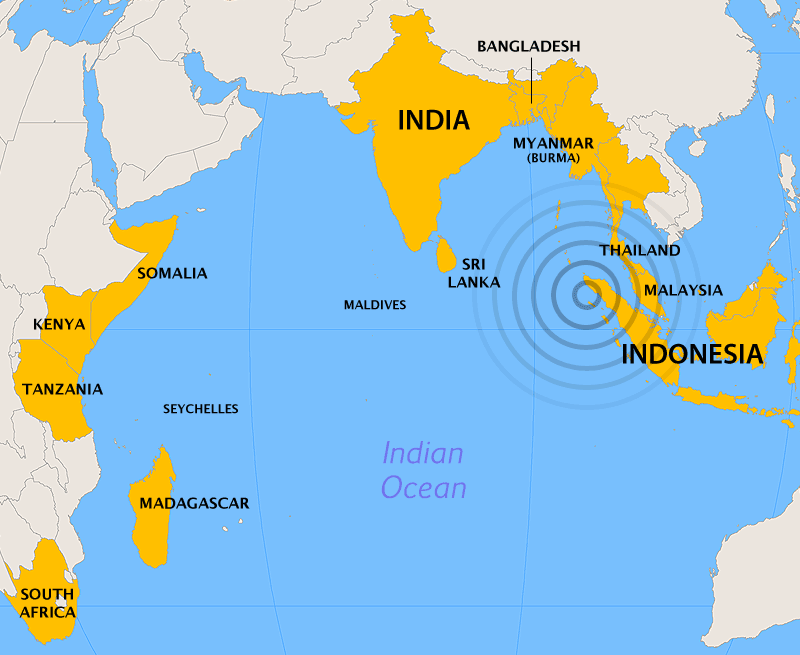
- Off the west coast of Aceh, northern Sumatra, Indonesia
- maximum_intensity
- Mercalli IX
- tsunami_max_height
- 30 m (100 ft)
- humanitarian_donations
- More than US$14 billion (equivalent to US$24 billion in 2025)
Lore & Background
The earthquake was caused by a rupture along the fault boundary between the Burma plate and the Indian plate, with the longest fault rupture ever observed, between 1,200 to 1,300 kilometers, and the longest duration of faulting ever observed, lasting at least ten minutes. The northern section of the Sunda megathrust ruptured over a length of 1,300 km, and the slip did not happen instantaneously but took place in two phases over several minutes, beginning off the coast of Aceh and proceeding north-westerly. The earthquake caused the entire planet to vibrate by as much as 10 mm and remotely triggered earthquakes as far away as Alaska.
Reader's Guide
It is also the worst natural disaster in the history of Indonesia, the Maldives, Sri Lanka, and Thailand. The earthquake and tsunami devastated communities along the surrounding coasts of the Indian Ocean, causing severe disruption to living conditions and commerce in coastal provinces. The plight of the affected people and countries prompted a worldwide humanitarian response, with donations totaling more than US$14 billion. Of all the moment released by earthquakes in the 100 years from 1906 through 2005, roughly one-eighth was due to this earthquake.
Did You Know?
- The earthquake had the longest fault rupture ever observed, between 1,200 to 1,300 kilometers.
- It caused the entire planet to vibrate by as much as 10 mm.
- The tsunami waves reached as far as Mexico, Chile, and the Arctic.
- The earthquake remotely triggered earthquakes as far away as Alaska.
The Rupture Beneath the Indian Ocean
On the morning of December 26, 2004, the boundary where the Indian plate slides beneath the Burma plate gave way in one of the most extraordinary seismic events ever measured. The hypocenter sat roughly 160 kilometers off the western shore of northern Sumatra, about 30 kilometers below sea level, just north of Simeulue Island. What followed was not a single snap but a two-stage rupture spanning an estimated 1,200 to 1,300 kilometers of fault surface, with roughly 15 meters of slip along the subduction zone. The first phase, a 400-kilometer rupture, tore northwestward at approximately 2.8 kilometers per second over about 100 seconds. After a pause of roughly the same length, the break continued northward toward the Andaman and Nicobar Islands at a slower pace of about 2.1 kilometers per second, persisting for another five minutes until it reached a zone where the fault geometry shifts from subduction to strike-slip. The entire faulting episode lasted at least ten minutes—the longest such duration ever recorded—and set the whole planet oscillating by as much as 10 millimeters, even triggering smaller quakes as distant as Alaska.
Waves of Devastation
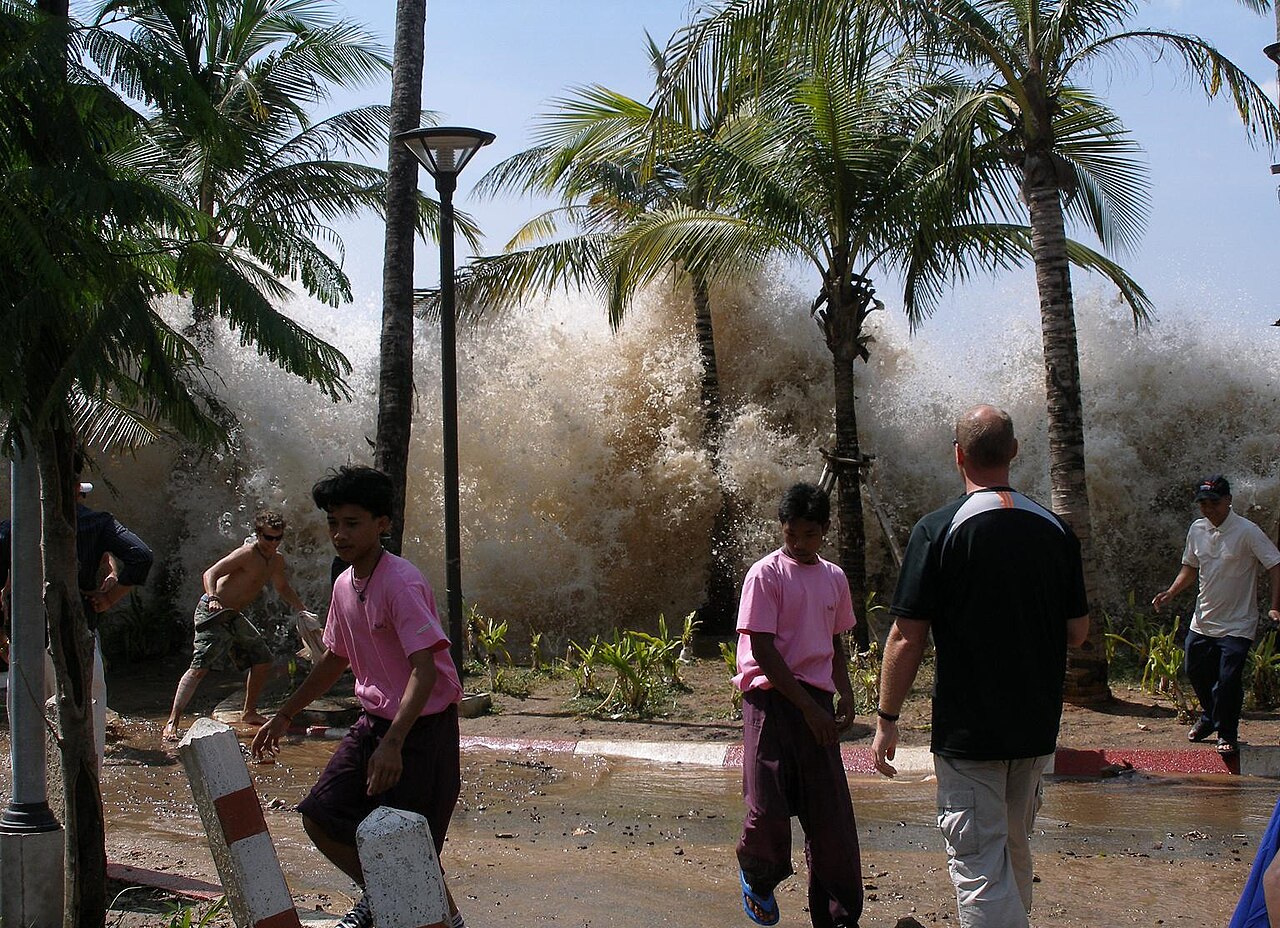
The seismic energy released beneath the Sunda megathrust translated into a tsunami of staggering proportions, with waves reaching heights of up to 30 meters as they struck populated coastlines. British and Commonwealth press dubbed the event the Boxing Day tsunami, while others called it the Asian tsunami, but the human cost transcended any label. An estimated 227,898 people perished across fourteen nations. The hardest-hit regions included Aceh in northern Indonesia, the eastern shores of Sri Lanka, the Tamil Nadu coastline of India, and the resort area of Khao Lak in Thailand. In Lhoknga, Indonesia, secondary splay faults caused narrow strips of seafloor to heave upward in seconds, abruptly amplifying both the height and velocity of incoming waves and obliterating the town. The shaking itself was felt across Bangladesh, India, Malaysia, Myanmar, Thailand, Sri Lanka, and the Maldives, with a maximum Mercalli intensity of IX registered in certain locales. The disaster inflicted severe disruption on daily life, infrastructure, and commerce throughout the coastal provinces of every affected country, and it stands as the deadliest tsunami ever recorded, the deadliest natural catastrophe of the twenty-first century, and the worst natural disaster in the recorded histories of Indonesia, the Maldives, Sri Lanka, and Thailand.
A Place in the Seismic Record
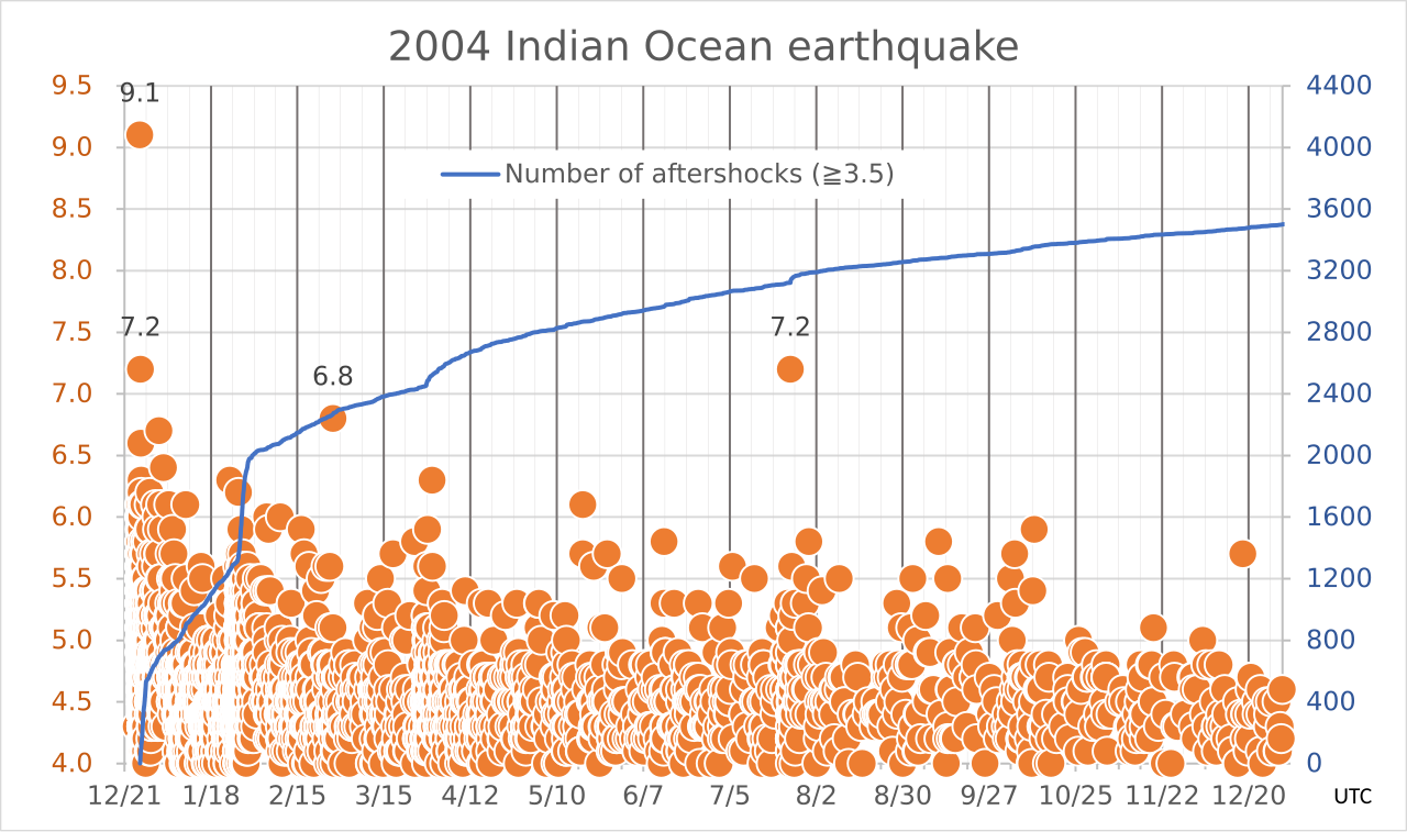
In terms of raw magnitude, the 2004 event sits at the very top of the modern catalog. Initially logged at a moment magnitude of 8.8, the figure was revised upward over the years; the US Geological Survey settled on Mw 9.1, while subsequent analyses by researchers such as Hiroo Kanamori at Caltech and a 2021 re-evaluation pushed the estimate to Mw 9.2 or 9.3. Since modern seismography began in 1900, only the 1960 Chilean earthquake at 9.5 and the 1964 Alaskan quake at 9.2 have registered higher, making the Sumatra–Andaman event the second- or third-strongest ever measured. It is the most powerful earthquake ever recorded in Asia and the strongest of the twenty-first century. Its fault rupture of 1,200 to 1,300 kilometers is the longest ever observed, and the ten-plus minutes of continuous faulting is likewise a record. When researchers tallied all seismic moment released between 1906 and 2005, roughly one-eighth of that total came from this single event. Together with the 1960 Chile and 1964 Alaska quakes, it accounts for nearly half of the century's total seismic moment.
A World Mobilized
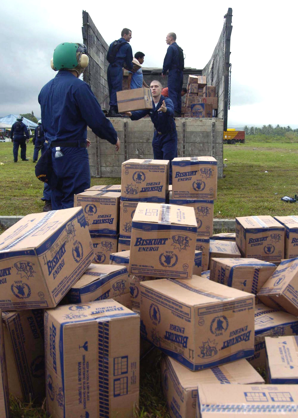
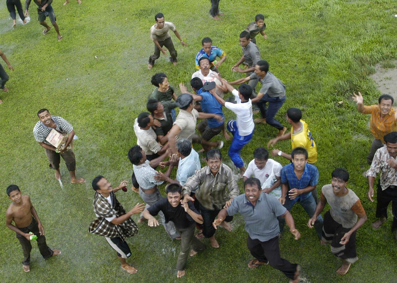
The sheer scale of suffering along the Indian Ocean rim triggered what became one of the largest coordinated humanitarian efforts in modern history. The plight of survivors in Aceh, Sri Lanka, Tamil Nadu, and Khao Lak—and in the other eleven affected nations—prompted governments, international organizations, and private citizens around the globe to channel resources toward relief. Donations ultimately exceeded fourteen billion US dollars, a sum equivalent to roughly twenty-four billion in 2025 currency. Beyond the immediate rescue and medical response, the disaster demanded long-term reconstruction of homes, schools, hospitals, ports, and the commercial networks that coastal communities depended on for livelihoods. The event also reshaped scientific and policy thinking: the 2002 Sumatra earthquake, which had struck the same fault zone more than two years earlier, was subsequently recognized as a probable foreshock, underscoring how little warning the region had received. The catastrophe's legacy extends into seismological research, disaster-preparedness planning, and the ongoing challenge of rebuilding in areas where population density along vulnerable coastlines makes future megathrust events potentially even more lethal.
Gallery
Frequently Asked Questions
What was the 2004 Indian Ocean earthquake and tsunami?
It was a massive undersea megathrust earthquake that struck on 26 December 2004, triggering a series of devastating tsunami waves that swept across the coastlines of the Indian Ocean. The event is also referred to in scientific literature as the Sumatra–Andaman earthquake.
How powerful was the earthquake and how tall did the tsunami waves get?
The quake registered a moment magnitude of 9.2 to 9.3 and reached Mercalli intensity IX at its peak. The resulting tsunami produced waves as high as 30 meters (about 100 feet) in some areas, overwhelming everything in their path.
Where did the 2004 tsunami originate?
The epicenter was located off the west coast of Aceh province in northern Sumatra, Indonesia. From there, the seismic energy propagated outward, sending destructive waves toward coastlines across the entire Indian Ocean basin.
Why is the 2004 event considered so historically significant?
It remains the single deadliest tsunami in recorded history, with its sheer scale of loss and the geographic breadth of its impact setting a grim benchmark. The disaster also prompted major international reforms in tsunami early-warning systems and coastal disaster preparedness.
More in Natural Disasters 1-15
Spotted an error? Know more?
This is a living reference — every entry is fact-audited, and reader corrections feed straight into our audit queue. Suggest an edit · See this site's audit record